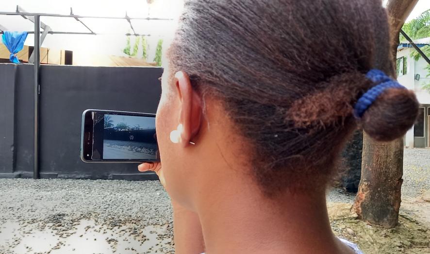
3D StreetView
On the right-hand side on this page, you see a recent video by Ivan Gayton to get an immediate and tangible feeling for 3D StreetView.
Many areas in the world are still not accurately mapped. Yet, up-to-date Digital Terrain Models, exposure data and cadastral information is much needed to better understand risks, address land ownership and develop commerical services.
Our 3D StreetView program aims to create a digital twin of the world, that anyone can contribute to using either simple Smart Phone cameras, affordable high quality Do-It-Yourself Open-Source 360 degree cameras to drones (self-built or commercial). We use scalable Structure-from-Motion workflows with the well-known OpenDroneMap software, to process data into free, up to date end user products.
We are currently developing a raspberry pi based 360-degree camera that allows rapid collection of high quality data. Please stay posted for more information.
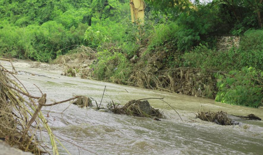
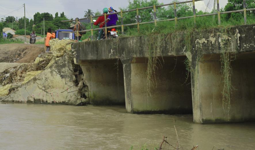
OpenRiverCam
World-wide, river observation networks are declining due to a too high cost and risky effort of maintenance of sites. Observations are often not freely and openly available to those that need it. River observations are essential for many, to predict and warn for floods, and more broadly, to monitor how our rivers’ respond to rainfall and other drivers, and how this changes as a consequence of severe land changes in their watersheds, and climate change. Rainbow Sensing and its partners, Trans-African HydroMeteorological Observatory, TU Delft, Uhuru Labs Waterboards Limburg and Wami Ruvu, develop low-cost, affordable, sustainable and safe workflows, consisting of hardware (including casing), firmware, software and front-ends to monitor streams with simple yet powerful instruments ranging from a smartphone to more sophisticated and permanent setups that can be assembled from affordable parts and operated with open-source software.
The movie below demonstrates the power of the open-source technology lying underneath this method.
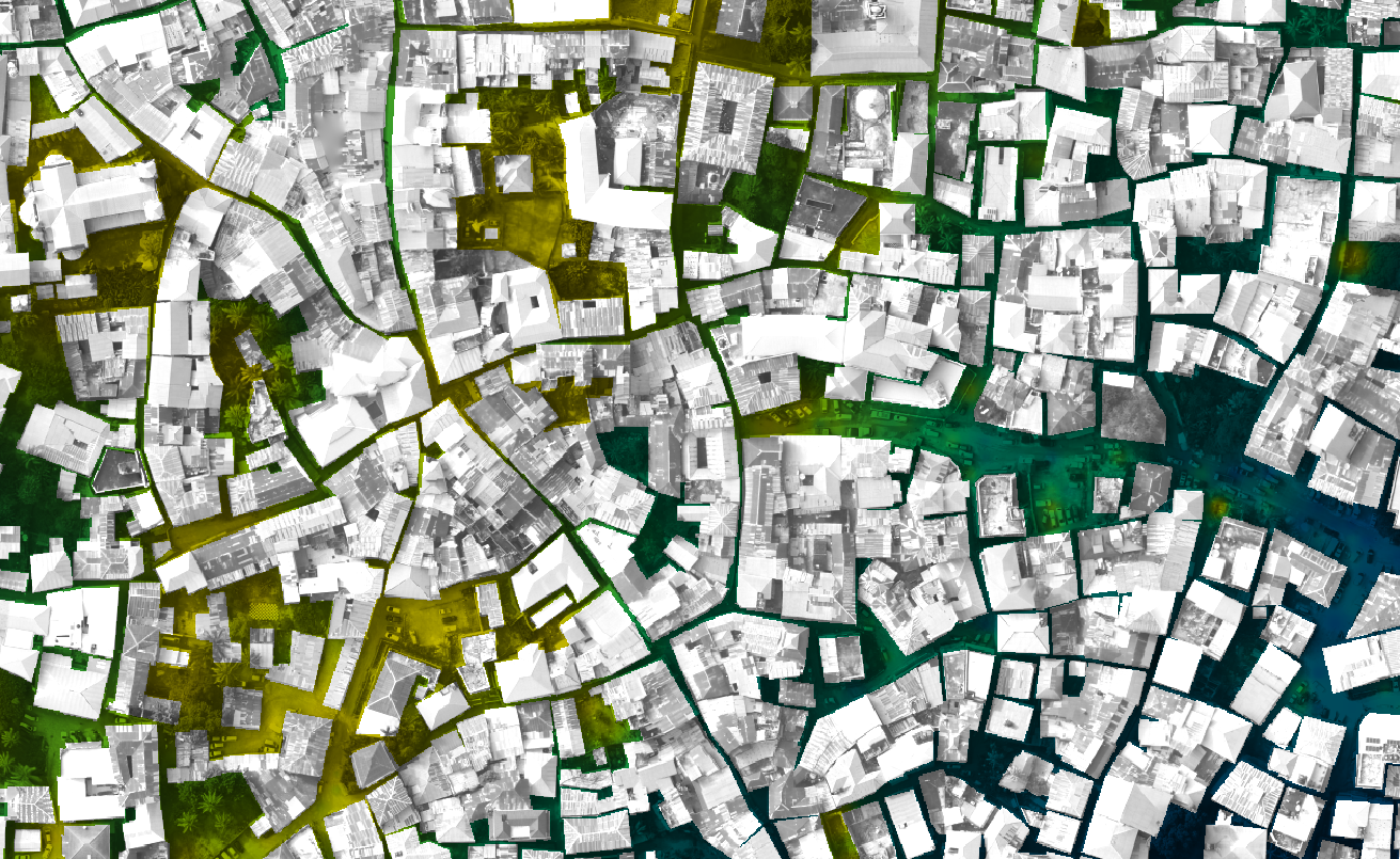
OpenCadaster
Land title deeds and survey boundaries of smallholder plots are a problem facing people in developing countries. People lack evidence of land ownership and accurate boundaries. This limits access opportunities like credit, and over generations it contributes to conflict. Traditional high-precision surveying tools and processes are prohibitively expensive and complex to use for small landholders. Rainbow Sensing helps build open, inexpensive and comprehensible tools for surveying with centimeter precision—sufficient for smallholder land. People and communities can use these tools to improve their land rights and opportunities.